Thursday, June 22, 2006
Day 4 June 22 Kah-nee-ta to Prineville,OR

BIKING IN CENTRAL OREGON
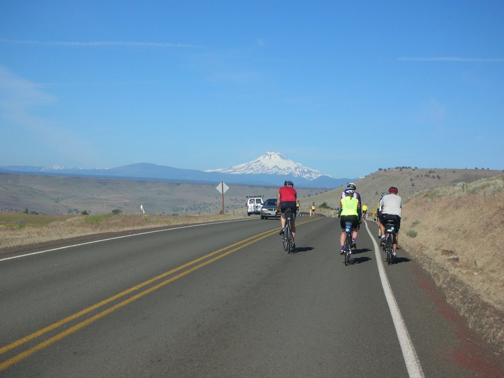
We departed the resort at 7:30 am in warm sunshine. The weather was a bonus on today's 61
mile ride to Prineville, OR. It was a shorter ride than normal, but we has some climbing -3900 feet- that gave us a challenge. The scenery was again remarkable and varied as we biked up and out of the box canyon from the Indian Reservation and into the small towns, farmlands, and grassy mesas of central Oregon.
We immediately encountered the first of several herds of horses roaming freely on the open range. They crossed the road in front of us and stood quietly for our cameras. Way up in the hills we saw a larger herd galloping to what must have been better grazing lands. Yesterday some cyclists suddenly came upon cattle in the road near the resort, nearly hitting them. They are restricted only by some cattle guards in the roads, which we find "jarring" when crossed on a bike.
Many of us stopped in the town of Warm Springs to tour the Indian Museum there. It showcased the history of the local tribes: the Wasco, Sahaptin, and the Pieutes. All were nomadic tribes whose main food sources were salmon, roots and berries. They moved from one location to the next to gather these food items. Three thousand Indians reside on this large reservation today.
Leaving Warm Springs and biking along side the DesShutes River with high bluffs forming a deep river valley, we watched fly fishermen standing in the rapid current trying their skills. It was a very calm setting.
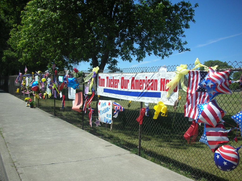
We reached the saddened town of Madras at the half way point of our ride today. The trees were tied with yellow ribbons and American flags were placed beside them. The signs on banks and in store windows offered prayers and thanks to their brave soldier's family. Madras is the hometown of Pfc Thomas Tucker, one of the two soldiers recently captured and killed in Iraq. A candlelight memorial is planned for Friday night in Friendship Park-- where our SAG stop was held today.
This arid region of central Oregon has irrigated farmlands which we rode past. Our concensus opinion of the major crop we saw was OATS. My non-farm cycling companions and I later learned it was ALFALFA. We saw many other crops later in the ride ....but none of us ventured a guess as to what we were seeing. We did confirm that it was Mt Jefferson that we could see in the background of these fields.
An area designated "US National Grasslands" was next along our route. Barren, desolate land was all we could see for many miles. In the last 20 miles we had some great flats and some descents, so we let it rip into Prineville, our destination.
Tomorrow is a MONSTER DAY!.....117 miles with 5500 feet of climbing. We'll be on the road by 5:45 am. I guess I'll miss the Crooked River Rodeo scheduled for tomorrow night in Prineville. Oh well, the life of a cyclist.
Bill
# posted by Bill Weidenfeller @ 8:11 PM 
Comments:
<< Home
Bill--Your trip interests those of us who publish "Rye Reflections", a year-old monthly citizens' website. We wish you luck and look forward to you dipping your wheel in the chilly Atlantic. best, jack driscoll
ps--OK if I copy a photo of you off your website to go with a short item about your trip? (driscoll@media.mit.edu)
Post a Comment
ps--OK if I copy a photo of you off your website to go with a short item about your trip? (driscoll@media.mit.edu)
# posted by  : 12:59 PM
: 12:59 PM << Home
![]()
